Oceanic Surveys? There’s an App for that.

Imagine being able to map ocean currents, temperatures, salinity, and depths from your desk in Raleigh, N.C. (By the way, for those of you unfamiliar with North Carolina geography, Raleigh is not a coastal town.)
Roy He and his team of NC State oceanographers are doing just that. They’re part of a growing trend among oceanographers that replaces costly seagoing expeditions with a small robotic glider that can be preprogrammed to explore certain areas of the sea and then communicate its data findings directly to the researchers via satellite.
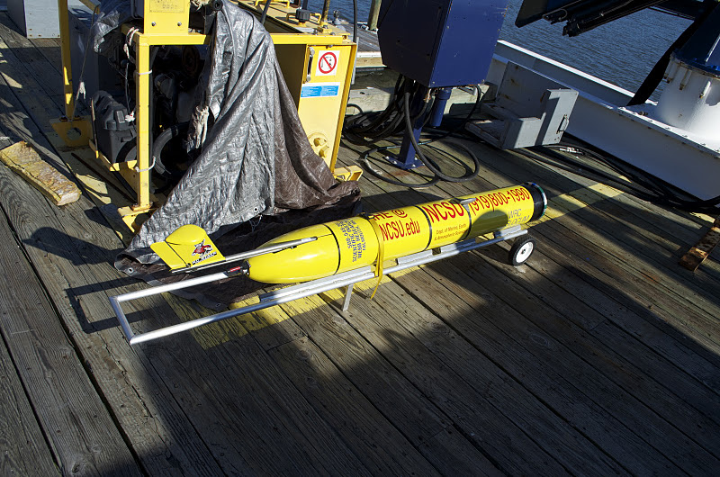
The glider is a 1.8 meter-long, torpedo-shaped electric vehicle that moves up and down in the ocean by changing its buoyancy. Wings on either side of the glider steer and propel it, enabling it to knife through the sea in a sawtooth pattern, taking depth, conductivity and temperature measurements. Then, at a pre-programmed time, the glider surfaces, links up to a satellite, and beams the collected data back to the researchers.
He and his group launched their glider Salacia, named after the Roman sea goddess and wife of Neptune, this past September. The maiden voyage was very successful, garnering data that can be assimilated into the coastal circulation prediction model his group has developed.
He believes that the Salacia is the wave of the future. “It will definitely be an important part of a global, integrated oceanic observation system. And it gives us opportunities to do observations even in hostile environments, such as storms and hurricanes, without risk to human life.”
- Categories:


