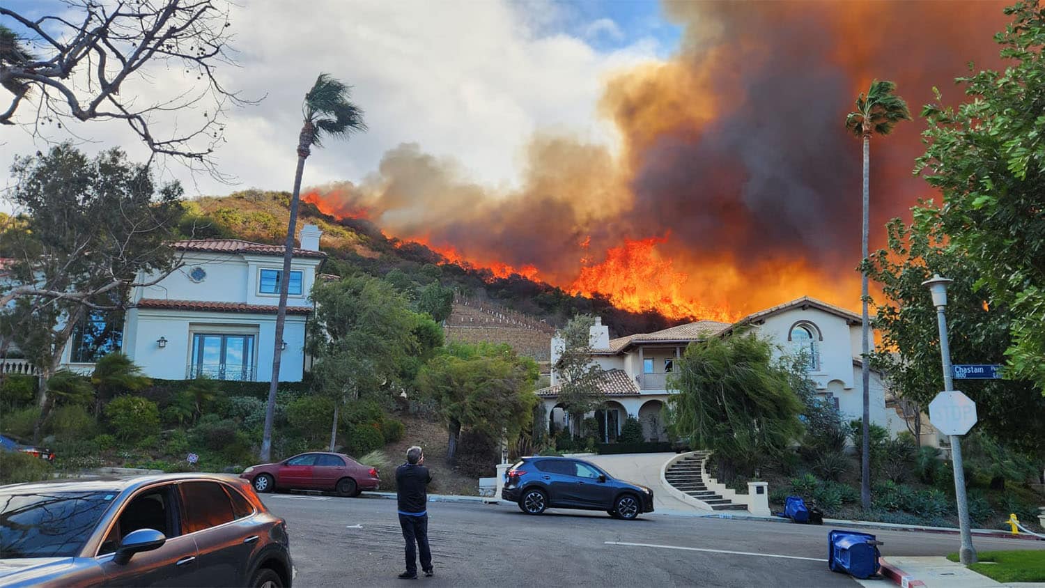
The Wild Ride of Preparing for Wildfires
Over the past week, Southern California wildfires have created an eerily similar natural disaster to the floods caused by Hurricane Helene in western North Carolina in September.

From typhoons in the South Pacific, to hurricanes on the North Carolina coast, to earthquakes near his home near the Pacific Palisades, Jim Yocum (mechanical engineering ’84) has seen a little bit of everything destructive nature has to offer.
Nothing, however, compares to the swift action he needed to take Jan. 8 when the California wildfires swept through the hometown Yocum adopted some 35 years ago.
The former NC State student body president (1982-83) was never officially given the order to evacuate his home in Santa Monica, which is just south of the worst destruction caused by the Palisades fire, but he loaded up his car with his family’s most valuable papers and possessions anyway and took them to his safe place on the other side of Los Angeles International Airport, a relatively safe region from some of the worst wildfires in California’s history.
“It’s bad here, like Dresden firestorm bad,” says Yocum, who was born in Fayetteville to Army parents and lived in Okinawa, among other places during his father’s deployments. “The entire center of town is leveled and most of the houses surrounded are gone, all the way down to the foundations.”
Yocum, his wife and two adult children were together Jan. 7 and were prepared to take action.

“You basically have all your stuff prepared at all times in a go bag,” says Yocom, who in 1994 narrowly missed being in the heart of the 6.7 magnitude Northridge earthquake that killed 67 people and damaged 6,000 homes because he was out of town on a skiing vacation. “You don’t have 24 to 72 hours like with a hurricane. The bare minimum essentials are always in the bag: important documents, hard drives, a laptop.
“You grab it and go — get in the car and leave.”
The medical software consultant with loyal ties to his alma mater stayed up overnight into Wednesday morning listening to the howling winds that blew up to 100 mph carrying the glowing embers that spread the fire uncontrollably in Palisades Park, Malibu and other well-known neighborhoods in Los Angeles County. The redwood windows of his 90-year-old home blew open, forcing him outside into the wind to push them closed.
His is a story repeated throughout the area, as 25 people were confirmed dead as of Wednesday and more than 30,000 homes have been lost, belonging to famous stars who live along the Pacific Coast Highway to multigenerational residents whose families first developed the area in the early 1930s.
The entire center of town is leveled and most of the houses surrounded are gone, all the way down to the foundations.
The two largest fires, Palisades and Eaton, have blown through the nearby canyons, on a larger scale than the 1978 Agoura-Malibu firestorm that killed three and the 1961 Belle Aire fire, both of which hit the same area. The straight-line Santa Ana winds have concentrated the fire in the Southern California canyons the same way flood waters overtook the valleys and hollows of the western North Carolina mountains during Hurricane Helene in September.
The two biggest natural disasters of the past year were eerily similar, even though the destruction was caused by opposing elements of water and fire.
Robert Scheller, associate dean of research for NC State’s College of Natural Resources and professor of landscape ecology in the department of forestry and environmental resources, has conducted wildfire research in western North Carolina, California and elsewhere in the United States.
While most of Scheller’s California research has been in the Sierra Nevada range, he is familiar with the patterns of the Santa Ana winds that cause the annual winter wildfire season.
“Los Angeles is a distinctly urban setting with a really large wildland-urban interface, where you have a lot of people living very close to flammable vegetation,” Scheller says. “You also have that in the Sierra Nevada, but not 10 million people living in the area.”
The destructive fires, fueled by dry vegetation and strong winds, are worsened by topography, just like the floods during Hurricane Helene and the 2018 Camp Fire in Paradise, California.
“Topography exaggerates the hazard,” Scheller says. “If you get wind going basically in parallel with a canyon, it just drives the wind even faster. It can really accelerate the wind speed, as it did with the Paradise fire, a city on a plateau with canyons on either side that make it prone to fires.”
Scheller says climate change has played a role in the recent fires, as California has been hit by unprecedented drought, increased aridity and longer burning seasons, as well as a weather whiplash of heavy flooding. Rain last winter followed by a recent period of months without rain created denser vegetation that then dried out to provide tinder for last week’s storms.
“It’s really hard to attribute any one fire to climate change,” Scheller says. “There’s just a stochastic nature to fire … as part of our earth system.
“However, if you zoom out from the individual fires and you look at these larger patterns across regions, that’s where you start to see really strong associations with climate change and the increased aridity globally.”
That aridity was to blame, in part, for the devastating Canadian wildfires in 2023, which burned in all 13 regions and destroyed nearly 5% of Canadian forests.
For now, Scheller says, the major concerns are putting out the ongoing fires, which are not yet fully contained, but also preparing for one of the worst environmental disasters of recent times in an area where many of the destroyed structures were built more than 90 years ago, when Los Angeles expanded to the Pacific Ocean.
“The pollution from all those burning homes is really intense,” he says. “It’s not like a fire burning in a forest. When you start burning homes and furniture, the amount of benzene and other nasty chemicals from burning couches, PVC pipes, [asbestos] and all the rest.”
The next worry, particularly in the mountains of North Carolina, is the downed trees and vegetation over the 820,000 acres of forest that have been drying out since the September hurricane. Spring winds could dry that out even more and a spark or lightning strike could create havoc in an area already decimated by floods.
“That leads to a lot of fuel on the ground, immediately all at once — just massive amounts of fuel,” Scheller says. “It is the same risk there now. It doesn’t have the population of Los Angeles or the housing density, but the risk is similar.”
- Categories:


