Editor’s note: Ever wonder what it would take to walk from one end of campus to the other? Read about the sights and sounds of NC State, with a little high-tech and modern research thrown in.
On the dusty dirt portion of Mid Pines Road, somewhere near NC State’s Lake Wheeler Road Field Laboratory and the Agroecology Education Farm, the turkey buzzards started flying overhead.
It seemed like a bad sign.
Yet that happened barely halfway through a projected 30-mile walk to the farthest edges of campus: east, south, west and north. An afternoon microburst that dumped two quick inches of rain on West Raleigh cut the walk some 3 miles short, near a soon-to-be-flooded spillway under a major urban intersection at PNC Arena.
The bulk of the unwalked portion was just backtracking down Hillsborough Street and the central part of campus—the parts of NC State most of us see every day.
If you are new to campus, whether an incoming student or newly hired faculty or staff, here are a few things you might wonder about as you wander this widely diverse campus trying to reach your daily step count or going on a longer weekend hike.
NC State’s three geographic precincts—main campus, Reedy Creek and Lake Wheeler—cover some 4,780 of Wake County’s 548,480 acres, according to university surveyor Heath Huovinen.
As the turkey buzzard flies, it’s only 7.5 miles.
Still, it’s no longer a compact campus on either side of the railway tracks with the singular, nose-in-a-book view of the Strolling Professor. It’s a sprawling urban home, crisscrossed by sidewalks, walking trails and greenways. (This map from NC State transportation shows you how long it takes, in minutes, to walk from place to place on campus.)
The grounds go from Carl A. Schenck Forest and the Reedy Creek Equine Farm, which shares a border with William B. Umstead State Park on the northern edge, to the bottom tip of Historic Yates Mill County Park on the southern.
Thanks to the work of the university architect’s office, facilities personnel and various groups intent on improving campus surroundings, exploring campus is no longer the pedestrian nightmare it once was, a place where the hidden edge of a brick leaps up to trip an innocent freshman or a new cluster hire.
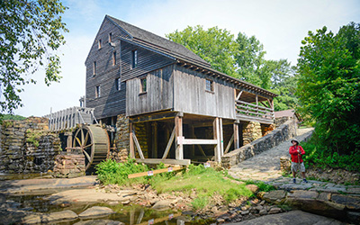
You’d be surprised by the variety of wildlife, ecology and landscapes you see. On this day, there were squirrels by the Belltower, deer darting across an urban road, a dead snake in a ditch with scavenger birds flying overhead. You can travel by community gardens, the Gardner and JC Raulston arboretums, bucolic pastures, busy city streets and even a few rushing interstate exchanges that are just on the other side of hidden forest trails.
From Yates Mill Pond to Edwards Mill Road, there is a little bit of everything.
You can watch the sun rise over the Belltower, then glimmer off the stainless steel sides of Hunt Library and burn off an early morning haze over downtown Raleigh from the 11th hole of the Lonnie Poole Golf Course.
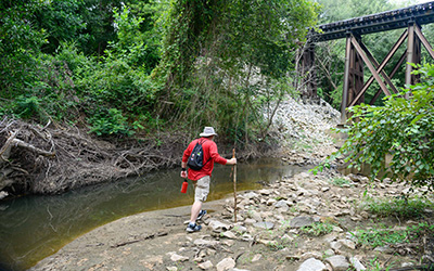
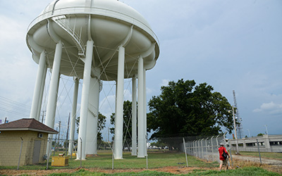
You can hit the low point of campus of 240 feet above sea level — located on the riverbed of Walnut Creek under a train trestle near a Raleigh greenway on the outer edge of Centennial Campus—and the high spot at 509 feet—under the light-blue water tower on Blue Ridge Road on the Centennial Biomedical Campus.
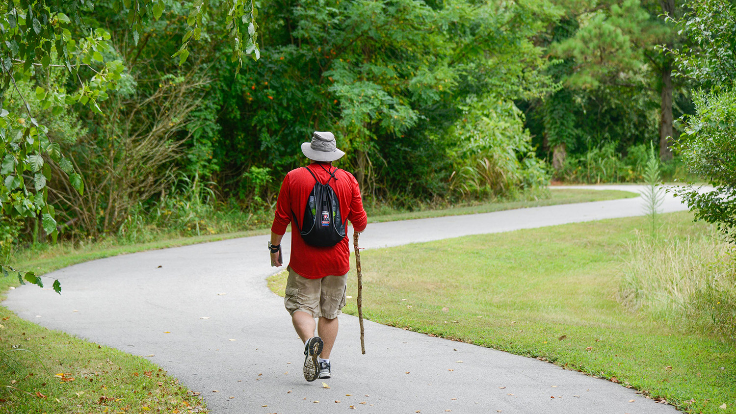
Walking campus in one day is not for the faint of heart: This walker recorded 58,317 steps on Fitbit, a total of 26.3 miles overall, covering 10 solid hours of walking and broken by 90 minutes for lunch and a short—and necessary—nap.
It wasn’t for naught. Researchers at ASSIST, a National Science Foundation-funded Nanosystems Engineering Research Center where cutting-edge wearable technology can record just about anything, gathered some 12 million bytes for a research team monitoring environmental data. The health and environmental tracker developed at ASSIST is about the size of a wristwatch and can gather accelerometry (motion) data, along with air quality, temperature, humidity and other variables.
Also pitching in for the day was the Center for Geospatial Analytics, a College of Natural Resources-based center that interprets location-based data to solve a host of problems. In this case, associate professor Aaron Hipp offered suggestions on how to turn a marathon walk into a daily resource for workplace wellness, noting that is particularly important for faculty and staff, who frequently come and go daily on campus, leaving a much larger carbon footprint than students who walk from class to class or party to party.
“NC State has a good network of greenways and walking trails that make it easy to go from place to place without leaving campus,” Hipp says. “There are free buses to get you to places on campus, and NC State is a certified bike-friendly university. All of those things help promote faculty and staff getting out of their offices and moving during their workday.”
There is a particular sustainability angle as well for those who drive too much: Every gallon of gasoline burned during transportation produces about 20 pounds of carbon dioxide, which means if you drive from your office to Carmichael Gym every day for a workout, you are likely leaving a Sasquatch-sized carbon footprint en route to a healthy lifestyle.
In terms of analytics, data gathered from the walk was taken by VieMetrics, ASSIST’s first spinoff company created by NC State students. VieMetrics, which won a $20,000 grant as a first-place winner at this year’s Lulu eGames, is perfecting the HET’s monitoring capabilities with the hopes of gathering ozone information in order to predict asthma attacks, based on a person’s reaction to increased ozone levels in ambient environments.
“Most of what we have done has been in controlled environments,” says Alper Bozkurt, associate professor in the Department of Electrical and Computer Engineering and ASSIST’s testbed leader of health and environmental tracking. “This was our first chance of having a guinea pig in the wild. This encourages us to have more.”

Jason Strohmaier, ASSIST’s chief systems engineer, explains that ASSIST works with the U.S. Environmental Protection Agency and the joint NC State-UNC biomedical engineering department to produce better results with the tracking systems developed at ASSIST.
“Having the opportunity to field-test the newest version of the tracking devices is an important part of its development,” Strohmaier says.
The walk began at sunrise at the Belltower on July 28, a day when the temperature reached a high of 94 degrees before the late-afternoon storm. The walker had two HET devices, an iPad to record the data, a buttonhole time-lapse camera, a University Recreation water bottle and an out-of-the-box pair of sneakers from NC State athletics apparel partner Adidas.
All survived the trip intact, though there was some question about the survivability of the test subject when multiple lightning strikes in the vicinity of PNC Arena sent him ducking for cover, nearly 4 miles away from the finish line.
The walk ended abruptly with a ride back to campus, and the circling turkey buzzards went looking for other dinner fare.
- Categories:


