UAVs and Christmas Trees: New Research to Help NC Growers Benefit From Drone Technology
High-tech tools meet holiday tradition in North Carolina this winter, thanks to a new research partnership that will explore how drone technology can help Christmas tree growers more efficiently measure and manage their unique crop.
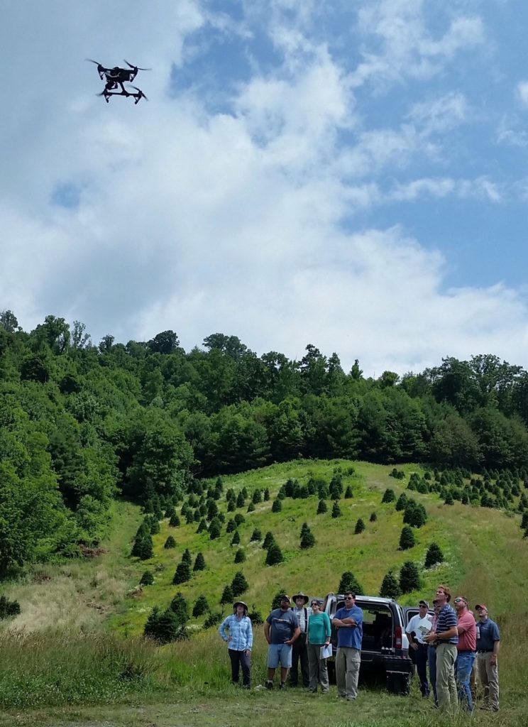
Researchers at North Carolina State University’s Center for Geospatial Analytics and Christmas Tree Extension will begin work in January on a two-year project in the Blue Ridge Mountains to test techniques for monitoring Christmas trees using drones, otherwise known as unmanned aerial vehicles or UAVs.
UAVs are commonly used in research to collect highly detailed, three-dimensional imagery of landscapes, and they have a lot of potential for helping Christmas tree farmers: “Instead of going out and measuring individual trees, a person could fly a drone” to get diameter and height information, or even detect discoloration caused by disease, explains Justyna Jeziorska, a research associate at the Center for Geospatial Analytics and expert in unmanned aerial systems (UAS).
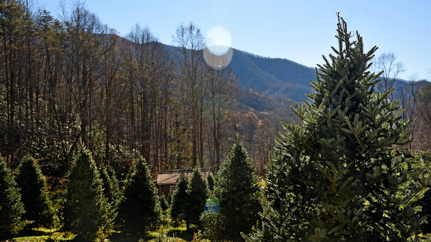
Christmas trees, though, pose some unique challenges for UAS: Fraser fir––the most popular Christmas tree species in North Carolina––grows best on steep slopes on mountain farms; such hilly terrain requires very particular flight planning. The software that processes 3-D drone imagery also tends to round treetops into domes, hardly the shape of a narrow-tipped Christmas tree.
A Task Just for Christmas Trees…and Then Some
“A lot of this research project is uniquely targeted to Christmas trees,” explains Zac Arcaro, the Center for Geospatial Analytics’ assistant director of operations and a collaborator on the project. “Hilly terrain will be a challenge; the tops of the trees need to be detectable; but principles we learn could also be used beyond Christmas trees.”
For example, the project will compare the performance of a “sprayer drone” with traditional spraying methods for applying necessary herbicide and pesticide to Christmas trees as they grow. Most drone models carry only a camera, and not an onboard tank capable of holding up to 10 kg of liquid; flying the bulkier drone requires special techniques.
Over the next year, Jeziorska will conduct dozens of drone flights on tree farms in the Blue Ridge Mountains, repeatedly analyzing collected imagery and testing different algorithms to accurately calculate tree height and diameter.
While performing this research, she will work closely with Jeff Owen, an extension specialist at NC State’s Mountain Horticultural Crops Research and Extension Center. “He knows everything there is to know about Christmas trees,” Jeziorksa explains, including how labor-intensive and time-consuming they are to inventory. Owen’s team at Christmas Tree Extension secured funding in 2018 to purchase the drones that Jeziorska will test, hoping to demonstrate how the technology can make tree growing operations more efficient and cost effective.
Spreading the Word
Once research is complete, project collaborators will share lessons learned with growers across the state. The team will develop educational materials and provide trainings for extension agents, benefiting an anticipated 850 growers.
“I don’t want to make people write code,”Jeziorska says. “No one will need to be an expert in GIS [Geographic Information Systems] to apply what we learn, and it will be tailored to the particular case of Christmas trees.” Jeziorska has taught dozens of practitioners how to use drones for their own work or research––through customized trainings and NC State’s popular UAS Operations & Analytics workshop––and emphasizes the importance of applying cutting-edge research to real-world settings.
Adds Arcaro, “If this research shows that drones are useful for managing Christmas trees, the info we provide will allow someone with their own interest and their own drone to do it themselves.”
Fast Facts About NC Christmas Trees
Sources: NC State Christmas Tree Extension, NC Christmas Tree Association
- North Carolina is the second largest producer of Christmas trees in the US. The state has roughly 40,000 acres in production, totaling about 50 million trees. That’s a lot of trees to measure without a drone!
- Almost 95% of all NC Christmas trees are Fraser fir, a tree native to the state that takes about 10 years to mature before harvest and grows best on steep slopes.
- In 2017, NC Christmas tree sales exceeded $86 million.
This post was originally published in Center for Geospatial Analytics.


