Study Finds Spreading Ghost Forests on N.C. Coast May Contribute to Climate Change

For Immediate Release
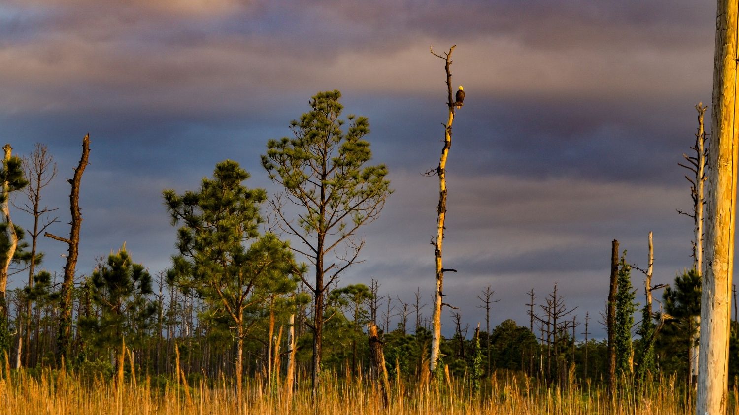
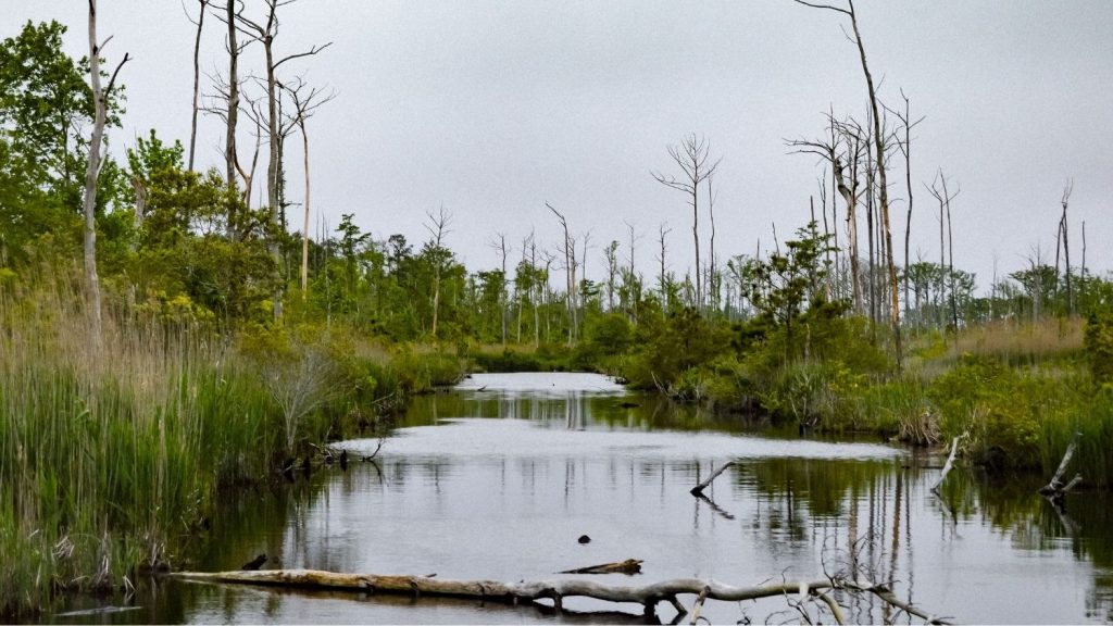
A new study found the spread of ghost forests across a coastal region of North Carolina may have implications for global warming. Ghost forests are areas where rising seas have killed off freshwater-dependent trees, leaving dead or dying white snags standing in marsh.
The study found that the transition from forest to marsh along the coastline of the Albemarle-Pamlico Peninsula led to a significant loss in the amount of carbon stored in the plants and trees above ground. When released into the atmosphere as a gas, carbon can contribute to global warming. However, researchers also uncovered some ways landowners can offset some of those carbon losses.
“Many people think about sea-level rise as being more of a long-term threat,” said the study’s lead author Lindsey Smart, a research associate at the North Carolina State University Center for Geospatial Analytics. “But we’re actually seeing significant changes over shorter time periods because of this interaction between gradual sea-level rise and extreme weather events like hurricanes or droughts, which can bring salt water further inland.”
In the study, researchers tracked the spread of ghost forests across 2,485 square miles on the peninsula. They found that on unmanaged, or natural, land such as publicly owned wildlife areas, ghost forests spread across 15 percent of the area between 2001 and 2014.
Using models created using data on vegetation height and type in the area, they calculated that across the 13 years of the study, 130,000 metric tons of carbon were lost from the spread of ghost forests on unmanaged land.
According to the U.S. Environmental Protection Agency’s Greenhouse Gas Equivalencies Calculator, that’s equivalent to what would be emitted into the air by 102,900 passenger vehicles driven for one year.
“Coastal forests are really unique in that they store carbon both in their foliage, and in their really rich organic soil,” Smart said. “As saltwater intrusion increases, you’re going to see impacts both to the aboveground and the belowground carbon. While we measured aboveground carbon losses, the next step will be to look at the response of these carbon stores below ground to saltwater exposure.”
Researchers said it’s unclear exactly what happens to the carbon released when the forests are killed by salt water, and it could be that it goes into the soil.
While they found ghost forests spread along the peninsula’s coastline, they also saw that the losses at the coast were offset by tree plantings in forests grown for timber during the study.
That was one land-management practice that they found could offset carbon losses due to ghost forest spread. They also saw that the use of canals and drainage ditches had an impact on carbon losses. Canals could either aid saltwater encroachment on the land, or help prevent it, depending on their use.
“Drainage networks, if not maintained, can serve as conduits for saltwater intrusion,” Smart said.

They also reported that catastrophic wildfires likely worsened the spread of ghost forest along the coast and had a greater impact on the loss of aboveground carbon compared with ghost forest spread.
“We think there may be an interaction between salt water and fire that accelerates forest retreat, and facilitates marsh migration into areas that were once healthy coastal forest,” Smart said.
The researchers said drought also played a role in ghost forest spreads.
“Two severe droughts within the study period produced larger-than-typical wildfires and facilitated salinization of normally freshwater ecosystems,” said study co-author Paul Taillie, a postdoctoral researcher at the University of Florida and former graduate student at N.C. State. “Thus the combination of rising sea level and future drought would be expected to cause a large net loss in biomass.”
Overall, the study helps create a map of areas that are particularly vulnerable to sea-level rise, and offers clues to help prevent loss of coastal forests.
“Our paper helps to identify areas that are most vulnerable to the impact of sea-level rise and extreme weather events,” Smart said. “This could help guide land-management decisions and help people think about ways to adapt to these changing environmental conditions.”
The paper, “Aboveground carbon loss associated with the spread of ghost forests as sea levels rise,” was published in the journal Environmental Research Letters. It was authored by Lindsey S. Smart, Paul J. Taillie, Benjamin Poulter, Jelena Vukomanovic, Kunwar K. Singh, Jennifer J. Swenson, Helena Mitasova, Jordan W. Smith and Ross K. Meentemeyer. The study was funded by a joint fellowship through NOAA’s North Carolina Sea Grant Program and NASA’s North Carolina Space Grant Program. Funding from a College of Natural Resources Innovation Grant at NC State was also used to support this research.
-oleniacz-
Note to editors: The abstract follows.
“Aboveground carbon loss associated with the spread of ghost forests as sea levels rise”
Authors: Lindsey S. Smart, Paul J. Taillie, Benjamin Poulter, Jelena Vukomanovic, Kunwar K. Singh, Jennifer J. Swenson, Helena Mitasova, Jordan W. Smith and Ross K. Meentemeyer.
Published Sept. 22, 2020.
Abstract: Coastal forests sequester and store more carbon than their terrestrial counterparts but are at greater risk of conversion due to sea level rise. Saltwater intrusion from sea level rise converts freshwater-dependent coastal forests to more salt-tolerant marshes, leaving ‘ghost forests’ of standing dead trees behind. Although recent research has investigated the drivers and rates of coastal forest decline, the associated changes in carbon storage across large extents have not been quantified. We mapped ghost forest spread across coastal North Carolina, USA, using repeat Light Detection and Ranging (LiDAR) surveys, multi-temporal satellite imagery, and field measurements of aboveground biomass to quantify changes in aboveground carbon. Between 2001 and 2014, 15% (167 km2) of unmanaged public land in the region changed from coastal forest to transition-ghost forest characterized by salt-tolerant shrubs and herbaceous plants. Salinity and proximity to the estuarine shoreline were significant drivers of these changes. This conversion resulted in a net aboveground carbon decline of 0.13 ± 0.01 TgC. Because saltwater intrusion precedes inundation and influences vegetation condition in advance of mature tree mortality, we suggest that aboveground carbon declines can be used to detect the leading edge of sea level rise. Aboveground carbon declines along the shoreline were offset by inland aboveground carbon gains associated with natural succession and forestry activities like planting (2.46 ± 0.25 TgC net aboveground carbon across study area). Our study highlights the combined effects of saltwater intrusion and land use on aboveground carbon dynamics of temperate coastal forests in North America. By quantifying the effects of multiple interacting disturbances, our measurement and mapping methods should be applicable to other coastal landscapes experiencing saltwater intrusion. As sea level rise increases the landward extent of inundation and saltwater exposure, investigations at these large scales are requisite for effective resource allocation for climate adaptation. In this changing environment, human intervention, whether through land preservation, restoration, or reforestation, may be necessary to prevent aboveground carbon loss.
- Categories:


