Visionary Program Eyes the Future
On a clear day, the view from the top floor of Jordan Hall extends toward downtown Raleigh, sweeping over a lush landscape of tall trees concealing homes, shops and streets under a canopy of green. It’s no surprise that the Center for Earth Observation set up shop here, high above Western Boulevard on the edge of central campus.
After all, if your business is geospatial research, location is everything.
“We live in space,” says Hugh Devine, the center’s director. “Everything happens somewhere, so it’s all our domain.”

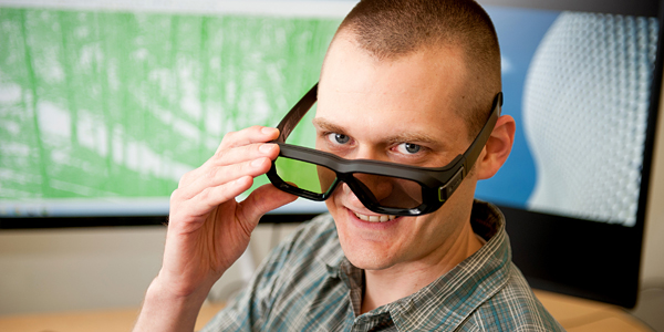
The center, which recently added a visualization lab, will demonstrate some of its most advanced tools at an open house 4-6 p.m. Thursday, May 9. There’s lots to see.
On a typical day in the center, you may find grad student Rahul Bhosle using a data visualization program to find the optimal locations for food distribution centers in poor neighborhoods where access to affordable food is limited. Or you may run into Makiko Shukunobe, a recent graduate who’s developing a virtual reality program that could be used to help train firefighters.
Highly Collaborative
In fact, the uses of geospatial technology are surprisingly varied and nearly limitless.

“It’s tied into things as far flung as environmental engineering, natural resource management, archeology, city planning, landscape architecture, bioinformatics and law enforcement,” Devine says. “It touches anything that involves transportation, mapping, moving and locational data.”
To prove it, he points to collaborations the center has with more than 20 departments at NC State this year, as well as partnerships with the new Hunt Library on Centennial Campus and the Nature Research Center at the Museum of Natural Sciences.
“It’s a wonderful field to be in,” he adds. “You deal with everybody.”
Skills in Demand
The center offers a Master of Geospatial Information Science and Technology as well as a graduate certificate and two graduate minors. The discipline is popular with students, Devine says, because the skills it teaches are in demand.
“Geospatial information trades into more competitiveness in the job markets,” he says.
As a result, the program is “bursting at the seams,” with 150 master’s students and 180 certificate students this semester.
- Categories:


